![[ Eclipse Anim. ]](EclpsAnim.gif)
![[Paraguaná]](Paragua3.gif)
Location: Paraguaná, Venezuela
(North is up)
![]() This combination of a satellite photograph of part of the peninsula of Paraguaná,
This combination of a satellite photograph of part of the peninsula of Paraguaná,
and a map of the whole peninsula, shows (in green) the Central Line of the eclipse.
It also shows (in red) the approximate paths of the available roads.
The shadow of totality, moved from South-West to North-East,
spanning all of the peninsula.
![]() All of the marked roads on the Northeast region of the peninsula,
All of the marked roads on the Northeast region of the peninsula,
North of 'El Pico' (Punta Salinas), the Westernmost tip of Paraguaná,
are just dirt paths, a four-wheel traction vehicle was advisable on these region.
![]() Varied supplies were available at Punto Fijo and Cardón,
Varied supplies were available at Punto Fijo and Cardón,
only the most basic at Pueblo Nuevo.
![]() The trip between Caracas and Paraguaná took aproximately 7 hours by car.
The trip between Caracas and Paraguaná took aproximately 7 hours by car.
![]() Probably the most convenient area from which to observe this eclipse from Paraguaná,
Probably the most convenient area from which to observe this eclipse from Paraguaná,
was to the Northwest of Punto Fijo, as this is the most developed part of the peninsula.
The area of Villa Marina and El Pico has beautiful beaches and good roads.
![]() We established ARVAL's observation site at Punta de Barco,
We established ARVAL's observation site at Punta de Barco,
on the Easternmost road that crosses the Central Line;
it is at sea level, in the radio station 'La Voz de Venezuela',
offering a good view of the Northeast coast, and beaches.
![]() To reach ARVAL's observation site:
To reach ARVAL's observation site:
Drive North from Coro to Paraguaná, crossing the isthmus,
upon reaching Dist. Los Olivos on the North end of the isthmus,
keep on driving North along the shore of the peninsula to Adícora,
in Adícora turn West to Pueblo Nuevo,
in Pueblo Nuevo turn North to El Vínculo,
in El Vínculo turn East by Northeast towards Las Camaraguas (an abandoned beach resort),
then turn Northwest along the shore to radio La Voz de Venezuela on Punta de Barco.
These are all good roads, no special vehicles are required.
![]() An alternate route (if coming from Punto Fijo) to Pueblo Nuevo is:
An alternate route (if coming from Punto Fijo) to Pueblo Nuevo is:
From El Cayude turn North to Santa Ana,
in Santa Ana turn Northwest to Moruy,
in Moruy turn North to Buena Vista,
keep on driving North to Pueblo Nuevo.
![]() Some waypoints:
Some waypoints:
Coro: 11° 25.42' N - 69° 40.18' W
Dist. Los Olivos: 11° 42.38' N - 69° 46.52' W
Adícora: 11° 56.56' N - 69° 48.45' W
Pueblo Nuevo: 11° 56.86' N - 69° 55.28' W
El Vínculo: 12° 03.94' N - 69° 56.91' W
Las Cumaraguas: 12° 06.42' N - 69° 53.80' W
Punta de Barco: 12° 09.88' N - 69° 55.90' W
Cabo San Román: 12° 12.00' N - 70° 01.00' W
Cardón: 11° 39.66' N - 70° 12.85' W
El Cayude: 11° 41.84' N - 69° 57.40' W
Santa Ana: 11° 46.86' N - 69° 56.92' W
Moruy: 11° 49.29' N - 69° 58.91' W
Buena Vista: 11° 52.46' N - 69° 56.62' W
Digital image processing by Martin Machnowski:
MM Design, Grand Rapids,
Michigan.
Public satellite photograph by: SPOT Imaging Satellites (for Paraguaná, enter 12° N, 70° W)
![]() On Thursday, 1998 February 26, a total eclipse of the Sun was visible
from within a narrow corridor which traversed the Western Hemisphere.
On Thursday, 1998 February 26, a total eclipse of the Sun was visible
from within a narrow corridor which traversed the Western Hemisphere.
The path of the Moon's umbral shadow began in the Pacific, continued
through northern South America and the Caribbean Sea, and ended at sunset
off the Atlantic coast of Africa.
A partial eclipse was seen within the much broader path of the Moon's
penumbral shadow, which included parts of the United States and eastern
Canada, Mexico, Central America and the northern half of South America.
NASA - Feb. '98 Eclipse (Home Page)
![]() Total Eclipse of the Sun on Thursday February 26th 1998:
Total Eclipse of the Sun on Thursday February 26th 1998:
Lat. 12° 9.88' N, Lon. 69° 55.9' W, 0m above sea level
(Punta de Barco, on the eclipse Central Line)
![[Eclipse Diagram]](SEclipse2.gif)
Venezuela (UTC - 4hrs.) local times:
Eclipse started: 12:38:19.6 (First Contact, Height 68.9°)
Totality started: 14:09:18.3 (Second Contact)
Center of Totality: 14:11:10.3 (Height 61.5°)
End of Totality: 14:13:2.3 (Third Contact)
End of Eclipse: 15:35:43.4 (Fourth Contact, Height 44.5°)
Duration of Totality: 3 min. 44.0 secs.
Data was projected using the Solar Eclipse Predictor v 1.0, by Worachate Boonplod.
Sun's Position at 14:11 (Local), 23:57 Local Sidereal Time:
R.A.: 22h 38m 25.3s Dec: 8° 35' 29" S
Azimuth: 224° 6' Height: 61° 32'
The Sun, rose at 06:56, transited at 12:52, and set at 18:48
Data was projected using TheSky, version 4, Software Bisque.
![]() At the other side of the Gulf of Venezuela, the totality spanned the city of Maracaibo
and the towns from Rosario to Maicao, but not Cabimas.
At the other side of the Gulf of Venezuela, the totality spanned the city of Maracaibo
and the towns from Rosario to Maicao, but not Cabimas.
What did totality look like?
Observatorio ARVAL: Total Eclipse of the Sun, February 26 '98 - Images
El Último Eclipse Solar del Milenio en América
(CANTV) (in Spanish)
Staigerland Eclipse '98
Solar Eclipse '98 - Live @ The Exploratorium
Bob Yen, Total Solar Eclipse, Feb. 26
'98 (High resolution film images have been posted here since the day of the eclipse)
Reports of the
1998 Total Solar Eclipse (Fred Espenak)
LIVE! ECLIPSE 98 on February 26, 1998
Fred Espenak:
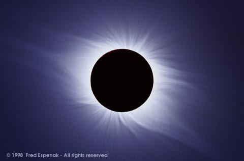
"Although Solar eclipses are easily photographed, it's nearly impossible to capture details in both the inner and outer corona in any single exposure. The corona's range in brightness is just too large for the dynamic range of today's photographic emulsions."
"In recent years, eclipse photographers have begun processing their images using the personal computer and image editing programs like Adobe Photoshop."
"This is one of my first efforts in eclipse photography composite imaging. The original images were made by me from Oranjestad, Aruba during the total Solar eclipse of 1998, February 26. A Sigma 400mm f/5.6 APO telephoto and a Sigma 2X teleconverter were used with a Nikon FE w/MD-12 motor drive. The exposures were made on Kodak Royal Gold 100 at 2, 1, 1/2, 1/4, 1/8, 1/15 and 1/125 seconds. I scanned the negatives using a Minolta QuickScan 35."
Visit
Fred Espenak's Web page on Solar Eclipse Composite Photography
Mercury, Jupiter, Venus, Mars and Fomalhaut were apparent near the Sun during Totality:
![]() Mercury;
Some 4° 7' East of the Sun,
Mercury;
Some 4° 7' East of the Sun,
at R.A. 22h 55m, Dec. 8° 37' S (aprox.),
Phase: 99%, Apparent Magnitude: -1.6
![]() Jupiter;
Some 2° 44' West of the Sun,
Jupiter;
Some 2° 44' West of the Sun,
at R.A. 22h 30m, Dec. 10° 22.5' S (aprox.),
Apparent Magnitude: -2
![]() Venus;
Some 42° 18' East of the Sun,
Venus;
Some 42° 18' East of the Sun,
at R.A. 19h 48m, Dec. 15° 57' S (aprox.),
Apparent Magnitude: -4.6
![]() Mars;
Some 17° 28' East of the Sun,
Mars;
Some 17° 28' East of the Sun,
at R.A. 23h 44m, Dec. 2° 31' S (aprox.),
Apparent Magnitude: 1.2
![]() Fomalhaut;
Some 21° 31' South of the Sun,
Fomalhaut;
Some 21° 31' South of the Sun,
at R.A. 22h 57.5m, Dec. 29° 38' S (aprox.),
Apparent Magnitude: 1.3
Technical Information:
According to the calculations of Fred Espenak, the following pair of data points encompass the Paraguaná peninsula:
Total Solar Eclipse of 1998 February 26
SAROS 130
Delta T =  62.8 Sec

           Northern Limit       Southern Limit         Center Line
Universal                                                               Diameter  Sun    Sun    Path    Duration
 Time    Latitude Longitude   Latitude Longitude   Latitude Longitude    Ratio    Alt.   Az.    Width   Totality

18:10     12 31.2   70 37.6    11 21.0   70  2.2    11 56.0   70 20.0   1.0427   62.1   223.4   144.1    3:45.3
18:12     12 54.7   69 56.7    11 44.6   69 21.7    12 19.6   69 39.3   1.0425   61.1   224.7   143.5    3:43.2
Only the first point falls inside the SPOT satellite photograph.
So, we expected the eclipse from a position on the Central Line, over the peninsula, to have its Totality centered around 18:11 UT (14:11 Local), and last for some 3:44 minutes.
The second point is on radial 59° True, 64° Mag., from the first, at a distance of 46.25NM.
This radial was used to determine the position for the observation site on the Central Line of
the eclipse, using a GPS receiver.
Very conveniently, this position was in the radio station "La Voz de Venezuela".
The position of Punta de Barco (12° 09.88' N - 69° 55.90' W) was used to calculate the results presented in this page.
![]() Other WWW sites with more information on this eclipse:
Other WWW sites with more information on this eclipse:
NASA - Feb. '98 Eclipse
NASA Eclipse Web Site
Eclipse Solar 1998 (Venezuela) (COVESOL '98)
The Eclipse Zone (Worachate Boonplod)
Solar-Eclipse Preview: February 26, 1998
(from Sky & Telescope, by Fred Espenak)
Solar Eclipse: February 26, 1998 (Astronomy Magazine)
The Eclipse Chaser home page (Jeffrey R. Charles)
El Último Eclipse Solar del Milenio en América (CANTV) (in Spanish)
![]() Warning:
Warning:
Never observe the Sun directly, nor with optical instruments, without the required special
filters, this would result in permanent damage to your eyesight.
To observe an eclipse during its partial phases, without optical instruments, project a small
image of the Sun on a screen of white cardboard, using as a "lens" a tiny pinhole punctured
with a needle in a sheet of aluminum foil.
Set the screen perpendicular to the Sun rays, and the aluminum foil between the screen and the
Sun, parallel to the screen. The distance between the "lens" and the screen determines the
size and brightness of the image.
Mounting the aluminum foil on a light frame, will make it easier to handle. Supporting the
screen on its correct position, will make this device easier to handle.
Constructing the whole device inside a shoebox, with only a sighthole on one of the sides, will
let you attain a larger image. Cut a hole into one end to support a small piece of foil with
the pinhole.
An arc-soldering filter #14, or a special Mylar filter, will let you look at the Sun directly.
Be sure to protect and instruct your children!
The damage to your eyesight occurs without pain!
Only during the totality, it is safe to observe an eclipse directly, or with optical
instruments.
But beware of the end of the totality!
![]() Updated: March 23 '98
Updated: March 23 '98
Best seen with MS Internet Explorer.
Back: ARVAL - Eclipse '98 Page
Messages: